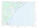
Maps showing Dadys Point, Gloucester, New Brunswick
Dadys Point is a Cape located in Gloucester, New Brunswick and has an elevation of 4 meters.
- Latitude: 47° 39' 46'' North (decimal: 47.6626523)
- Longitude: 64° 51' 59'' West (decimal: -64.8664531)
- Topography Feature Category: Cape
- Geographical Feature: Point
- Canadian Province/Territory: New Brunswick
- Elevation: 4 meters
- Location: Gloucester
- Atlas of Canada Locator Map: Dadys Point
- GPS Coordinate Locator Map: Dadys Point Lat/Long