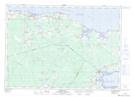
Maps showing Lac des Boudreau, Westmorland, New Brunswick
Lac des Boudreau is a Bay located in Westmorland, New Brunswick and has an elevation of 4 meters.
- Latitude: 46° 13' 55'' North (decimal: 46.2319324)
- Longitude: 64° 28' 8'' West (decimal: -64.4689824)
- Topography Feature Category: Bay
- Geographical Feature: Cove
- Canadian Province/Territory: New Brunswick
- Elevation: 4 meters
- Location: Westmorland
- Atlas of Canada Locator Map: Lac des Boudreau
- GPS Coordinate Locator Map: Lac des Boudreau Lat/Long