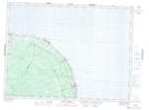
Maps showing Boulay Pond, Gloucester, New Brunswick
Boulay Pond is a Lake located in Gloucester, New Brunswick and has an elevation of 143 meters.
- Latitude: 47° 48' 47'' North (decimal: 47.8130703)
- Longitude: 65° 53' 57'' West (decimal: -65.8990343)
- Topography Feature Category: Lake
- Geographical Feature: Pond
- Canadian Province/Territory: New Brunswick
- Elevation: 143 meters
- Location: Gloucester
- Atlas of Canada Locator Map: Boulay Pond
- GPS Coordinate Locator Map: Boulay Pond Lat/Long
Boulay Pond NTS Map Sheets