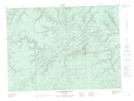
Maps showing Mount Brittain, Restigouche, New Brunswick
Mount Brittain is a Mountain located in Restigouche, New Brunswick and has an elevation of 513 meters.
- Latitude: 47° 30' 2'' North (decimal: 47.5006725)
- Longitude: 66° 34' 16'' West (decimal: -66.5710699)
- Topography Feature Category: Mountain
- Geographical Feature: Mount
- Canadian Province/Territory: New Brunswick
- Elevation: 513 meters
- Location: Restigouche
- Atlas of Canada Locator Map: Mount Brittain
- GPS Coordinate Locator Map: Mount Brittain Lat/Long
Mount Brittain NTS Map Sheets