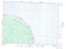
Maps showing Étang du Sud, Gloucester, New Brunswick
Étang du Sud is a Lake located in Gloucester, New Brunswick and has an elevation of 184 meters.
- Latitude: 47° 47' 21'' North (decimal: 47.7890835)
- Longitude: 65° 55' 41'' West (decimal: -65.9279434)
- Topography Feature Category: Lake
- Geographical Feature: Étang
- Canadian Province/Territory: New Brunswick
- Elevation: 184 meters
- Location: Gloucester
- Atlas of Canada Locator Map: Étang du Sud
- GPS Coordinate Locator Map: Étang du Sud Lat/Long
Étang du Sud NTS Map Sheets