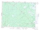
Maps showing Sullivans Lake, Kent, New Brunswick
Sullivans Lake is a Lake located in Kent, New Brunswick and has an elevation of 36 meters.
- Latitude: 46° 45' 49'' North (decimal: 46.7637029)
- Longitude: 65° 7' 1'' West (decimal: -65.1169983)
- Topography Feature Category: Lake
- Geographical Feature: Lake
- Canadian Province/Territory: New Brunswick
- Elevation: 36 meters
- Location: Kent
- Atlas of Canada Locator Map: Sullivans Lake
- GPS Coordinate Locator Map: Sullivans Lake Lat/Long
Sullivans Lake NTS Map Sheets