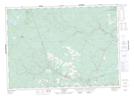
Maps showing Sutherland Siding, York, New Brunswick
Sutherland Siding is a Unincorporated area located in York, New Brunswick and has an elevation of 83 meters.
- Latitude: 46° 16' 32'' North (decimal: 46.2756493)
- Longitude: 66° 40' 35'' West (decimal: -66.6763358)
- Topography Feature Category: Unincorporated area
- Geographical Feature: Railway Point
- Canadian Province/Territory: New Brunswick
- Elevation: 83 meters
- Location: York
- Atlas of Canada Locator Map: Sutherland Siding
- GPS Coordinate Locator Map: Sutherland Siding Lat/Long
Sutherland Siding NTS Map Sheets