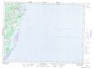
Maps showing Swinging Point, Northumberland, New Brunswick
Swinging Point is a Cape located in Northumberland, New Brunswick and has an elevation of 0 meters.
- Latitude: 47° 17' 21'' North (decimal: 47.2890847)
- Longitude: 64° 57' 48'' West (decimal: -64.9632504)
- Topography Feature Category: Cape
- Geographical Feature: Point
- Canadian Province/Territory: New Brunswick
- Elevation: 0 meters
- Location: Northumberland
- Atlas of Canada Locator Map: Swinging Point
- GPS Coordinate Locator Map: Swinging Point Lat/Long
Swinging Point NTS Map Sheets