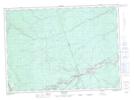
Maps showing Brown Bar, Northumberland, New Brunswick
Brown Bar is a Island located in Northumberland, New Brunswick and has an elevation of 45 meters.
- Latitude: 46° 34' 19'' North (decimal: 46.5718622)
- Longitude: 66° 4' 52'' West (decimal: -66.0810771)
- Topography Feature Category: Island
- Geographical Feature: Island
- Canadian Province/Territory: New Brunswick
- Elevation: 45 meters
- Location: Northumberland
- Atlas of Canada Locator Map: Brown Bar
- GPS Coordinate Locator Map: Brown Bar Lat/Long