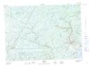
Maps showing Bull Pasture Plains, Sunbury, New Brunswick
Bull Pasture Plains is a Low vegetation located in Sunbury, New Brunswick and has an elevation of 109 meters.
- Latitude: 46° 2' 32'' North (decimal: 46.0422582)
- Longitude: 66° 19' 11'' West (decimal: -66.3195852)
- Topography Feature Category: Low vegetation
- Geographical Feature: Plains
- Canadian Province/Territory: New Brunswick
- Elevation: 109 meters
- Location: Sunbury
- Atlas of Canada Locator Map: Bull Pasture Plains
- GPS Coordinate Locator Map: Bull Pasture Plains Lat/Long