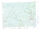
Maps showing Burpee Deadwater, Sunbury, New Brunswick
Burpee Deadwater is a River feature located in Sunbury, New Brunswick and has an elevation of 116 meters.
- Latitude: 46° 3' 14'' North (decimal: 46.0538207)
- Longitude: 66° 25' 58'' West (decimal: -66.4326713)
- Topography Feature Category: River feature
- Geographical Feature: Deadwater
- Canadian Province/Territory: New Brunswick
- Elevation: 116 meters
- Location: Sunbury
- Atlas of Canada Locator Map: Burpee Deadwater
- GPS Coordinate Locator Map: Burpee Deadwater Lat/Long