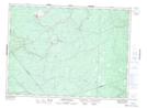
Maps showing Taylor Brook, Gloucester, New Brunswick
Taylor Brook is a River located in Gloucester, New Brunswick and has an elevation of 272 meters.
- Latitude: 47° 21' 10'' North (decimal: 47.3526561)
- Longitude: 65° 59' 38'' West (decimal: -65.9940106)
- Topography Feature Category: River
- Geographical Feature: Brook
- Canadian Province/Territory: New Brunswick
- Elevation: 272 meters
- Location: Gloucester
- Atlas of Canada Locator Map: Taylor Brook
- GPS Coordinate Locator Map: Taylor Brook Lat/Long
Taylor Brook NTS Map Sheets