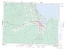
Maps showing Tetagouche Falls, Gloucester, New Brunswick
Tetagouche Falls is a Falls located in Gloucester, New Brunswick and has an elevation of 116 meters.
- Latitude: 47° 37' 2'' North (decimal: 47.6172855)
- Longitude: 65° 49' 31'' West (decimal: -65.8251411)
- Topography Feature Category: Falls
- Geographical Feature: Falls
- Canadian Province/Territory: New Brunswick
- Elevation: 116 meters
- Location: Gloucester
- Atlas of Canada Locator Map: Tetagouche Falls
- GPS Coordinate Locator Map: Tetagouche Falls Lat/Long