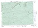
Maps showing The Sheds, Restigouche, New Brunswick
The Sheds is a Unincorporated area located in Restigouche, New Brunswick.
- Latitude: 47° 43' North (decimal: 47.7166999)
- Longitude: 66° 15' West (decimal: -66.2499999)
- Topography Feature Category: Unincorporated area
- Geographical Feature: Locality
- Canadian Province/Territory: New Brunswick
- Location: Restigouche
- GPS Coordinate Locator Map: The Sheds Lat/Long
The Sheds NTS Map Sheets