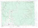
Maps showing Thibault, Restigouche, New Brunswick
Thibault is a Unincorporated area located in Restigouche, New Brunswick and has an elevation of 303 meters.
- Latitude: 47° 36' 32'' North (decimal: 47.6087626)
- Longitude: 67° 20' 38'' West (decimal: -67.3439159)
- Topography Feature Category: Unincorporated area
- Geographical Feature: Dispersed Rural Community
- Canadian Province/Territory: New Brunswick
- Elevation: 303 meters
- Location: Restigouche
- Atlas of Canada Locator Map: Thibault
- GPS Coordinate Locator Map: Thibault Lat/Long
Thibault NTS Map Sheets