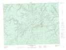
Maps showing Thirteen Mile Brook, Restigouche, New Brunswick
Thirteen Mile Brook is a River located in Restigouche, New Brunswick and has an elevation of 192 meters.
- Latitude: 47° 37' 59'' North (decimal: 47.6329193)
- Longitude: 66° 52' 28'' West (decimal: -66.8743657)
- Topography Feature Category: River
- Geographical Feature: Brook
- Canadian Province/Territory: New Brunswick
- Elevation: 192 meters
- Location: Restigouche
- Atlas of Canada Locator Map: Thirteen Mile Brook
- GPS Coordinate Locator Map: Thirteen Mile Brook Lat/Long
Thirteen Mile Brook NTS Map Sheets