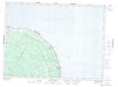
Maps showing Turgeon, Gloucester, New Brunswick
Turgeon is a Unincorporated area located in Gloucester, New Brunswick and has an elevation of 49 meters.
- Latitude: 47° 53' 5'' North (decimal: 47.8845837)
- Longitude: 65° 51' 55'' West (decimal: -65.8652878)
- Topography Feature Category: Unincorporated area
- Geographical Feature: Railway Point
- Canadian Province/Territory: New Brunswick
- Elevation: 49 meters
- Location: Gloucester
- Atlas of Canada Locator Map: Turgeon
- GPS Coordinate Locator Map: Turgeon Lat/Long
Turgeon NTS Map Sheets