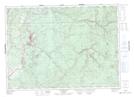
Maps showing Odell River, Victoria, New Brunswick
Odell River is a Unincorporated area located in Victoria, New Brunswick and has an elevation of 114 meters.
- Latitude: 46° 48' 58'' North (decimal: 46.8160181)
- Longitude: 67° 25' 50'' West (decimal: -67.4305549)
- Topography Feature Category: Unincorporated area
- Geographical Feature: Railway Point
- Canadian Province/Territory: New Brunswick
- Elevation: 114 meters
- Location: Victoria
- Atlas of Canada Locator Map: Odell River
- GPS Coordinate Locator Map: Odell River Lat/Long
Odell River NTS Map Sheets