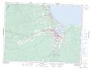
Maps showing Outer Channel, Gloucester, New Brunswick
Outer Channel is a Channel located in Gloucester, New Brunswick and has an elevation of 0 meters.
- Latitude: 47° 39' 39'' North (decimal: 47.6608321)
- Longitude: 65° 36' 57'' West (decimal: -65.6157309)
- Topography Feature Category: Channel
- Geographical Feature: Channel
- Canadian Province/Territory: New Brunswick
- Elevation: 0 meters
- Location: Gloucester
- Atlas of Canada Locator Map: Outer Channel
- GPS Coordinate Locator Map: Outer Channel Lat/Long