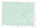
Maps showing The Oxbow, Kent, New Brunswick
The Oxbow is a River feature located in Kent, New Brunswick and has an elevation of 56 meters.
- Latitude: 46° 24' 47'' North (decimal: 46.4129478)
- Longitude: 65° 15' 1'' West (decimal: -65.2502738)
- Topography Feature Category: River feature
- Geographical Feature: Oxbow
- Canadian Province/Territory: New Brunswick
- Elevation: 56 meters
- Location: Kent
- Atlas of Canada Locator Map: The Oxbow
- GPS Coordinate Locator Map: The Oxbow Lat/Long