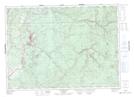
Maps showing Ox Island, Victoria, New Brunswick
Ox Island is a Island located in Victoria, New Brunswick and has an elevation of 119 meters.
- Latitude: 46° 52' 54'' North (decimal: 46.8815977)
- Longitude: 67° 25' 36'' West (decimal: -67.4267925)
- Topography Feature Category: Island
- Geographical Feature: Island
- Canadian Province/Territory: New Brunswick
- Elevation: 119 meters
- Location: Victoria
- Atlas of Canada Locator Map: Ox Island
- GPS Coordinate Locator Map: Ox Island Lat/Long
Ox Island NTS Map Sheets