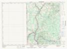
Maps showing Lake Edward, Victoria, New Brunswick
Lake Edward is a Unincorporated area located in Victoria, New Brunswick and has an elevation of 227 meters.
- Latitude: 46° 54' 19'' North (decimal: 46.9052162)
- Longitude: 67° 39' 21'' West (decimal: -67.6559648)
- Topography Feature Category: Unincorporated area
- Geographical Feature: Dispersed Rural Community
- Canadian Province/Territory: New Brunswick
- Elevation: 227 meters
- Location: Victoria
- Atlas of Canada Locator Map: Lake Edward
- GPS Coordinate Locator Map: Lake Edward Lat/Long
Lake Edward NTS Map Sheets