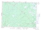
Maps showing Laketon Lake, Kent, New Brunswick
Laketon Lake is a Lake located in Kent, New Brunswick and has an elevation of 63 meters.
- Latitude: 46° 51' 37'' North (decimal: 46.8603300)
- Longitude: 65° 9' 8'' West (decimal: -65.1522040)
- Topography Feature Category: Lake
- Geographical Feature: Lake
- Canadian Province/Territory: New Brunswick
- Elevation: 63 meters
- Location: Kent
- Atlas of Canada Locator Map: Laketon Lake
- GPS Coordinate Locator Map: Laketon Lake Lat/Long
Laketon Lake NTS Map Sheets