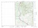
Maps showing Lawrence Lakes, Carleton, New Brunswick
Lawrence Lakes is a Lake located in Carleton, New Brunswick and has an elevation of 146 meters.
- Latitude: 46° 32' 3'' North (decimal: 46.5342295)
- Longitude: 67° 44' 33'' West (decimal: -67.7424397)
- Topography Feature Category: Lake
- Geographical Feature: Lakes
- Canadian Province/Territory: New Brunswick
- Elevation: 146 meters
- Location: Carleton
- Atlas of Canada Locator Map: Lawrence Lakes
- GPS Coordinate Locator Map: Lawrence Lakes Lat/Long
Lawrence Lakes NTS Map Sheets