Maps showing Leech, Gloucester, New Brunswick
Leech is a Unincorporated area located in Gloucester, New Brunswick and has an elevation of 14 meters.
- Latitude: 47° 27' 12'' North (decimal: 47.4532414)
- Longitude: 64° 58' 55'' West (decimal: -64.9818382)
- Topography Feature Category: Unincorporated area
- Geographical Feature: Dispersed Rural Community
- Canadian Province/Territory: New Brunswick
- Elevation: 14 meters
- Location: Gloucester
- Atlas of Canada Locator Map: Leech
- GPS Coordinate Locator Map: Leech Lat/Long
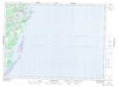
Leech NTS Map Sheets