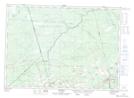
Maps showing Leeman Hill, Westmorland, New Brunswick
Leeman Hill is a Mountain located in Westmorland, New Brunswick and has an elevation of 128 meters.
- Latitude: 46° 3' 59'' North (decimal: 46.0663544)
- Longitude: 65° 9' 55'' West (decimal: -65.1651677)
- Topography Feature Category: Mountain
- Geographical Feature: Hill
- Canadian Province/Territory: New Brunswick
- Elevation: 128 meters
- Location: Westmorland
- Atlas of Canada Locator Map: Leeman Hill
- GPS Coordinate Locator Map: Leeman Hill Lat/Long