Maps showing Left Hand Branch Little Gulquac River, Victoria, New Brunswick
Left Hand Branch Little Gulquac River is a River located in Victoria, New Brunswick and has an elevation of 174 meters.
- Latitude: 46° 58' 14'' North (decimal: 46.9704583)
- Longitude: 67° 16' 11'' West (decimal: -67.2698603)
- Topography Feature Category: River
- Geographical Feature: Branch
- Canadian Province/Territory: New Brunswick
- Elevation: 174 meters
- Location: Victoria
- Atlas of Canada Locator Map: Left Hand Branch Little Gulquac River
- GPS Coordinate Locator Map: Left Hand Branch Little Gulquac River Lat/Long
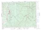
Left Hand Branch Little Gulquac River NTS Map Sheets