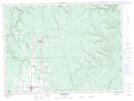
Maps showing Lower Downs Gulch, Restigouche, New Brunswick
Lower Downs Gulch is a Valley located in Restigouche, New Brunswick and has an elevation of 200 meters.
- Latitude: 47° 44' 31'' North (decimal: 47.7418469)
- Longitude: 67° 28' 46'' West (decimal: -67.4793385)
- Topography Feature Category: Valley
- Geographical Feature: Gulch
- Canadian Province/Territory: New Brunswick
- Elevation: 200 meters
- Location: Restigouche
- Atlas of Canada Locator Map: Lower Downs Gulch
- GPS Coordinate Locator Map: Lower Downs Gulch Lat/Long
Lower Downs Gulch NTS Map Sheets