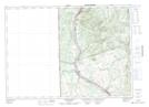
Maps showing Lower Kintore, Victoria, New Brunswick
Lower Kintore is a Unincorporated area located in Victoria, New Brunswick and has an elevation of 194 meters.
- Latitude: 46° 40' 21'' North (decimal: 46.6723978)
- Longitude: 67° 39' 00'' West (decimal: -67.6499428)
- Topography Feature Category: Unincorporated area
- Geographical Feature: Dispersed Rural Community
- Canadian Province/Territory: New Brunswick
- Elevation: 194 meters
- Location: Victoria
- Atlas of Canada Locator Map: Lower Kintore
- GPS Coordinate Locator Map: Lower Kintore Lat/Long
Lower Kintore NTS Map Sheets