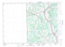
Maps showing Lower Presque Isle Island, Carleton, New Brunswick
Lower Presque Isle Island is a Island located in Carleton, New Brunswick and has an elevation of 61 meters.
- Latitude: 46° 21' 36'' North (decimal: 46.3598772)
- Longitude: 67° 33' 41'' West (decimal: -67.5615066)
- Topography Feature Category: Island
- Geographical Feature: Island
- Canadian Province/Territory: New Brunswick
- Elevation: 61 meters
- Location: Carleton
- Atlas of Canada Locator Map: Lower Presque Isle Island
- GPS Coordinate Locator Map: Lower Presque Isle Island Lat/Long
Lower Presque Isle Island NTS Map Sheets