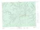
Maps showing Lower Southeast Falls, Restigouche, New Brunswick
Lower Southeast Falls is a Falls located in Restigouche, New Brunswick and has an elevation of 138 meters.
- Latitude: 47° 40' 20'' North (decimal: 47.6721171)
- Longitude: 66° 39' 47'' West (decimal: -66.6630662)
- Topography Feature Category: Falls
- Geographical Feature: Falls
- Canadian Province/Territory: New Brunswick
- Elevation: 138 meters
- Location: Restigouche
- Atlas of Canada Locator Map: Lower Southeast Falls
- GPS Coordinate Locator Map: Lower Southeast Falls Lat/Long
Lower Southeast Falls NTS Map Sheets