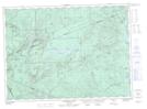
Maps showing Lower West Branch Portage Brook, Northumberland, New Brunswick
Lower West Branch Portage Brook is a River located in Northumberland, New Brunswick and has an elevation of 320 meters.
- Latitude: 47° 26' 24'' North (decimal: 47.4399732)
- Longitude: 66° 32' 46'' West (decimal: -66.5460128)
- Topography Feature Category: River
- Geographical Feature: Branch
- Canadian Province/Territory: New Brunswick
- Elevation: 320 meters
- Location: Northumberland
- Atlas of Canada Locator Map: Lower West Branch Portage Brook
- GPS Coordinate Locator Map: Lower West Branch Portage Brook Lat/Long
Lower West Branch Portage Brook NTS Map Sheets