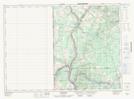
Maps showing Lucys Gulch, Victoria, New Brunswick
Lucys Gulch is a Valley located in Victoria, New Brunswick and has an elevation of 158 meters.
- Latitude: 46° 57' 22'' North (decimal: 46.9561864)
- Longitude: 67° 40' 6'' West (decimal: -67.6682524)
- Topography Feature Category: Valley
- Geographical Feature: Gulch
- Canadian Province/Territory: New Brunswick
- Elevation: 158 meters
- Location: Victoria
- Atlas of Canada Locator Map: Lucys Gulch
- GPS Coordinate Locator Map: Lucys Gulch Lat/Long
Lucys Gulch NTS Map Sheets