Maps showing Ludlow, Northumberland, New Brunswick
Ludlow is a Unincorporated area located in Northumberland, New Brunswick and has an elevation of 77 meters.
- Latitude: 46° 29' 25'' North (decimal: 46.4901832)
- Longitude: 66° 20' 41'' West (decimal: -66.3448451)
- Topography Feature Category: Unincorporated area
- Geographical Feature: Dispersed Rural Community
- Canadian Province/Territory: New Brunswick
- Elevation: 77 meters
- Location: Northumberland
- Atlas of Canada Locator Map: Ludlow
- GPS Coordinate Locator Map: Ludlow Lat/Long
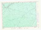
Ludlow NTS Map Sheets