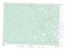
Maps showing Luke Brook, Kent, New Brunswick
Luke Brook is a River located in Kent, New Brunswick and has an elevation of 55 meters.
- Latitude: 46° 21' 19'' North (decimal: 46.3552787)
- Longitude: 65° 0' 9'' West (decimal: -65.0023914)
- Topography Feature Category: River
- Geographical Feature: Brook
- Canadian Province/Territory: New Brunswick
- Elevation: 55 meters
- Location: Kent
- Atlas of Canada Locator Map: Luke Brook
- GPS Coordinate Locator Map: Luke Brook Lat/Long
Luke Brook NTS Map Sheets