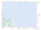
Maps showing The Lump, Northumberland, New Brunswick
The Lump is a Shoal located in Northumberland, New Brunswick.
- Latitude: 47° 7' North (decimal: 47.1167000)
- Longitude: 64° 58' West (decimal: -64.9666999)
- Topography Feature Category: Shoal
- Geographical Feature: Lump
- Canadian Province/Territory: New Brunswick
- Location: Northumberland
- Atlas of Canada Locator Map: The Lump
- GPS Coordinate Locator Map: The Lump Lat/Long
The Lump NTS Map Sheets