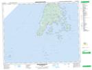
Maps showing White Head Harbour, Charlotte, New Brunswick
White Head Harbour is a Bay located in Charlotte, New Brunswick and has an elevation of 2 meters.
- Latitude: 44° 37' 37'' North (decimal: 44.626932)
- Longitude: 66° 43' 30'' West (decimal: -66.7250785)
- Topography Feature Category: Bay
- Geographical Feature: Harbour
- Canadian Province/Territory: New Brunswick
- Elevation: 2 meters
- Location: Charlotte
- Atlas of Canada Locator Map: White Head Harbour
- GPS Coordinate Locator Map: White Head Harbour Lat/Long
White Head Harbour NTS Map Sheets