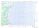
Maps showing Middle Kouchibouguac, Kent, New Brunswick
Middle Kouchibouguac is a Unincorporated area located in Kent, New Brunswick and has an elevation of 12 meters.
- Latitude: 46° 48' 8'' North (decimal: 46.8022215)
- Longitude: 64° 59' 21'' West (decimal: -64.9890643)
- Topography Feature Category: Unincorporated area
- Geographical Feature: Locality
- Canadian Province/Territory: New Brunswick
- Elevation: 12 meters
- Location: Kent
- Atlas of Canada Locator Map: Middle Kouchibouguac
- GPS Coordinate Locator Map: Middle Kouchibouguac Lat/Long
Middle Kouchibouguac NTS Map Sheets