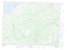
Maps showing Miller Brook, Gloucester, New Brunswick
Miller Brook is a Unincorporated area located in Gloucester, New Brunswick.
- Latitude: 47° 40' North (decimal: 47.6666999)
- Longitude: 65° 29' West (decimal: -65.4833000)
- Topography Feature Category: Unincorporated area
- Geographical Feature: Station
- Canadian Province/Territory: New Brunswick
- Location: Gloucester
- GPS Coordinate Locator Map: Miller Brook Lat/Long
Miller Brook NTS Map Sheets