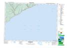
Maps showing Quiddy River, Saint John, New Brunswick
Quiddy River is a River located in Saint John, New Brunswick and has an elevation of 18 meters.
- Latitude: 45° 29' 44'' North (decimal: 45.4956185)
- Longitude: 65° 11' 40'' West (decimal: -65.1944245)
- Topography Feature Category: River
- Geographical Feature: River
- Canadian Province/Territory: New Brunswick
- Elevation: 18 meters
- Location: Saint John
- Atlas of Canada Locator Map: Quiddy River
- GPS Coordinate Locator Map: Quiddy River Lat/Long
Quiddy River NTS Map Sheets