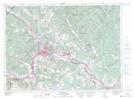
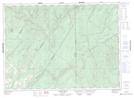
Maps showing Rang-des-Deschêne, Madawaska, New Brunswick
Rang-des-Deschêne is a Unincorporated area located in Madawaska, New Brunswick and has an elevation of 214 meters.
- Latitude: 47° 15' 11'' North (decimal: 47.2531679)
- Longitude: 67° 59' 46'' West (decimal: -67.9961860)
- Topography Feature Category: Unincorporated area
- Geographical Feature: Dispersed Rural Community
- Canadian Province/Territory: New Brunswick
- Elevation: 214 meters
- Location: Madawaska
- Atlas of Canada Locator Map: Rang-des-Deschêne
- GPS Coordinate Locator Map: Rang-des-Deschêne Lat/Long
Rang-des-Deschêne NTS Map Sheets