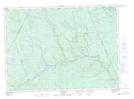
Maps showing Rangers Rocks, York, New Brunswick
Rangers Rocks is a Shoal located in York, New Brunswick and has an elevation of 239 meters.
- Latitude: 46° 30' 2'' North (decimal: 46.5005893)
- Longitude: 66° 58' 15'' West (decimal: -66.9709303)
- Topography Feature Category: Shoal
- Geographical Feature: Rocks
- Canadian Province/Territory: New Brunswick
- Elevation: 239 meters
- Location: York
- Atlas of Canada Locator Map: Rangers Rocks
- GPS Coordinate Locator Map: Rangers Rocks Lat/Long
Rangers Rocks NTS Map Sheets