Maps showing Rang-Quatorze, Restigouche, New Brunswick
Rang-Quatorze is a Unincorporated area located in Restigouche, New Brunswick and has an elevation of 310 meters.
- Latitude: 47° 29' 43'' North (decimal: 47.4953441)
- Longitude: 67° 21' 22'' West (decimal: -67.3560765)
- Topography Feature Category: Unincorporated area
- Geographical Feature: Dispersed Rural Community
- Canadian Province/Territory: New Brunswick
- Elevation: 310 meters
- Location: Restigouche
- Atlas of Canada Locator Map: Rang-Quatorze
- GPS Coordinate Locator Map: Rang-Quatorze Lat/Long
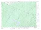
Rang-Quatorze NTS Map Sheets