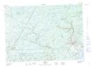
Maps showing Red Brook, York, New Brunswick
Red Brook is a River located in York, New Brunswick and has an elevation of 150 meters.
- Latitude: 46° 8' 55'' North (decimal: 46.1487231)
- Longitude: 66° 23' 56'' West (decimal: -66.3988897)
- Topography Feature Category: River
- Geographical Feature: Brook
- Canadian Province/Territory: New Brunswick
- Elevation: 150 meters
- Location: York
- Atlas of Canada Locator Map: Red Brook
- GPS Coordinate Locator Map: Red Brook Lat/Long