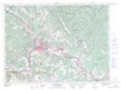
Maps showing Ruisseau à Blanchette, Madawaska, New Brunswick
Ruisseau à Blanchette is a River located in Madawaska, New Brunswick and has an elevation of 188 meters.
- Latitude: 47° 25' 25'' North (decimal: 47.4235499)
- Longitude: 68° 19' 42'' West (decimal: -68.3284634)
- Topography Feature Category: River
- Geographical Feature: Ruisseau
- Canadian Province/Territory: New Brunswick
- Elevation: 188 meters
- Location: Madawaska
- Atlas of Canada Locator Map: Ruisseau à Blanchette
- GPS Coordinate Locator Map: Ruisseau à Blanchette Lat/Long
Ruisseau à Blanchette NTS Map Sheets