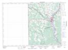
Maps showing Elmwood Station, Carleton, New Brunswick
Elmwood Station is a Unincorporated area located in Carleton, New Brunswick and has an elevation of 180 meters.
- Latitude: 46° 4' 46'' North (decimal: 46.0793594)
- Longitude: 67° 43' 27'' West (decimal: -67.7242714)
- Topography Feature Category: Unincorporated area
- Geographical Feature: Railway Point
- Canadian Province/Territory: New Brunswick
- Elevation: 180 meters
- Location: Carleton
- Atlas of Canada Locator Map: Elmwood Station
- GPS Coordinate Locator Map: Elmwood Station Lat/Long
Elmwood Station NTS Map Sheets