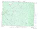
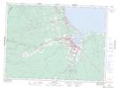
Maps showing Flemming Brook, Gloucester, New Brunswick
Flemming Brook is a River located in Gloucester, New Brunswick and has an elevation of 76 meters.
- Latitude: 47° 32' 23'' North (decimal: 47.5396532)
- Longitude: 65° 44' 33'' West (decimal: -65.7425051)
- Topography Feature Category: River
- Geographical Feature: Brook
- Canadian Province/Territory: New Brunswick
- Elevation: 76 meters
- Location: Gloucester
- Atlas of Canada Locator Map: Flemming Brook
- GPS Coordinate Locator Map: Flemming Brook Lat/Long
Flemming Brook NTS Map Sheets