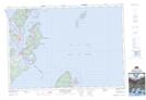
Maps showing Red Head, Charlotte, New Brunswick
Red Head is a Cape located in Charlotte, New Brunswick and has an elevation of 27 meters.
- Latitude: 44° 53' 23'' North (decimal: 44.8895972)
- Longitude: 66° 54' 10'' West (decimal: -66.9026449)
- Topography Feature Category: Cape
- Geographical Feature: Head
- Canadian Province/Territory: New Brunswick
- Elevation: 27 meters
- Location: Charlotte
- Atlas of Canada Locator Map: Red Head
- GPS Coordinate Locator Map: Red Head Lat/Long
Red Head NTS Map Sheets