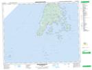
Maps showing Red Point, Charlotte, New Brunswick
Red Point is a Cape located in Charlotte, New Brunswick and has an elevation of 13 meters.
- Latitude: 44° 38' 52'' North (decimal: 44.6477650)
- Longitude: 66° 49' 6'' West (decimal: -66.8183148)
- Topography Feature Category: Cape
- Geographical Feature: Point
- Canadian Province/Territory: New Brunswick
- Elevation: 13 meters
- Location: Charlotte
- Atlas of Canada Locator Map: Red Point
- GPS Coordinate Locator Map: Red Point Lat/Long
Red Point NTS Map Sheets