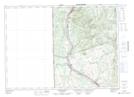
Maps showing Reid Lake, Carleton, New Brunswick
Reid Lake is a Lake located in Carleton, New Brunswick and has an elevation of 152 meters.
- Latitude: 46° 32' 51'' North (decimal: 46.5474669)
- Longitude: 67° 44' 35'' West (decimal: -67.7431644)
- Topography Feature Category: Lake
- Geographical Feature: Lake
- Canadian Province/Territory: New Brunswick
- Elevation: 152 meters
- Location: Carleton
- Atlas of Canada Locator Map: Reid Lake
- GPS Coordinate Locator Map: Reid Lake Lat/Long
Reid Lake NTS Map Sheets